Property Details
Property Details
by admin on May.29, 2003, under Land Details
Juniper Valley Ranch is a 38 acre wedge shaped parcel, approximately 2000 feet on the north and south sides, 1500 feet on the east side, and 300 feet on the west side. It is part of the Sierra Verde Ranch development. There are mountains surrounding us on three sides, isolating us from most of the rest of the world.
It is located in Unit 26 of the Sierra Verde Ranch development. Section 33, T23N, R8W, G.&S.R.M. Yavapai County, Arizona. The relief map below shows the nature of the terrain around the ranch. You can see that the west opens up to a large basin, and there are mountains on the other three sides.
Here is a closer view of the relief map.
Here is an aerial photo overlaid with topographic lines, as well as the Ranch outline and existing road.
The overhead photo of the ranch shows the Juniper and Pinyon tree cover on the north and south sides pretty well. The stream shown through the middle of the meadow is actually shown incorrectly. If you look closely, you can see that the actual path is along the south edge of the meadow.
Here are the gps coordinates for the property markers.
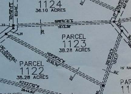
Here is a subdivision plot for Unit 26. Click on the picture for a Huge Version (350kb)
Here is a wide area topo map showing the two access roads you can reach the ranch from. Click on the picture for a Huge Version (450 kb).
Here is a full plot of section 33. Click the picture to see a Huge Version (250 kb).
25 April 2008
Here is an updated aerial view from the Yavapai County GIS Services. You
can clearly see our little house and the tent-trailer near the
upper-right hand corner.


Comments
Post a Comment